c.1834 Panoramic Map of the River Thames
c.1834 Panoramic Map of the River Thames
Couldn't load pickup availability
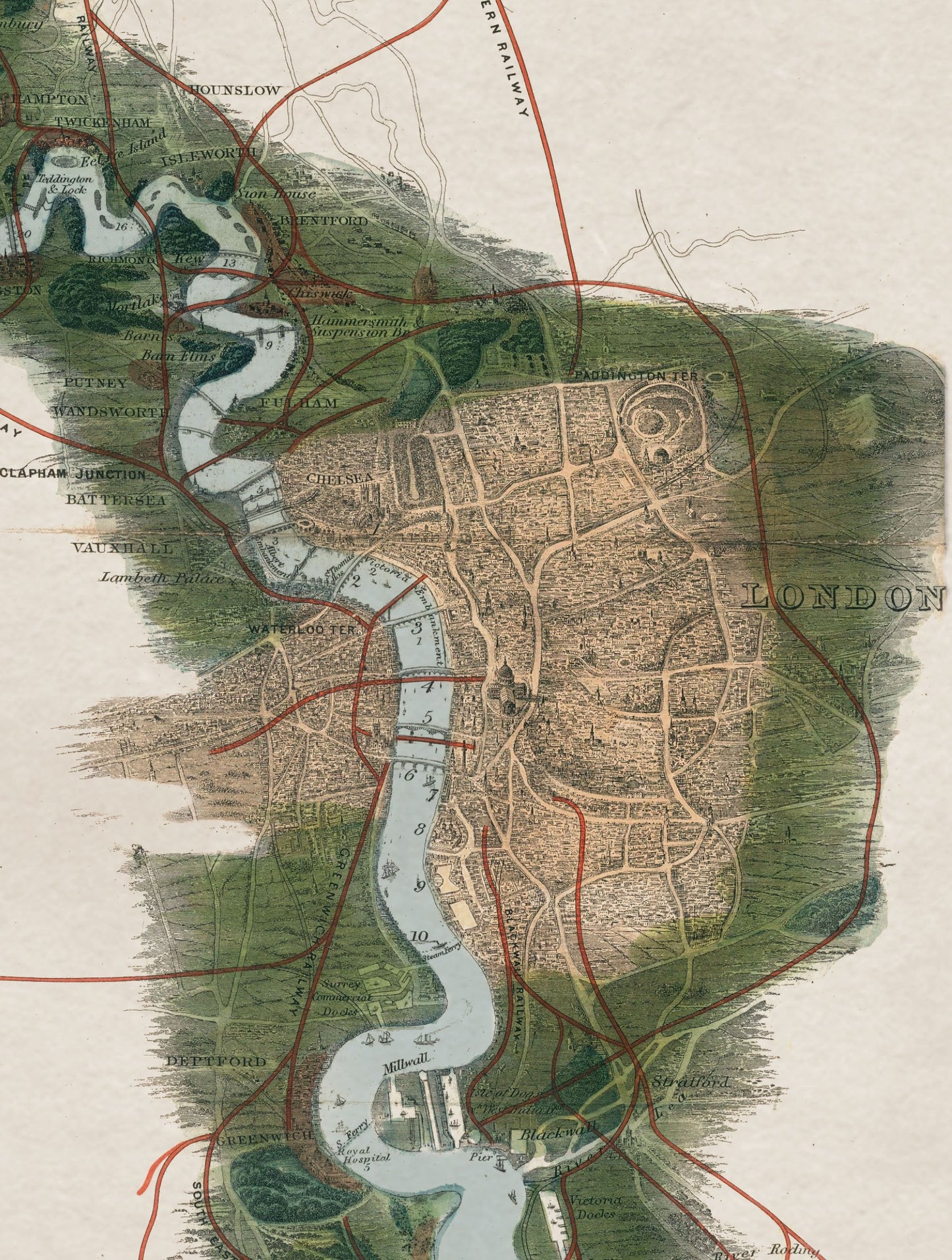
This striking 1.6m tall frame illustrates a complete panoramic view of the river Thames, from its source in Gloucestershire to its estuary in the North Sea. It brings back to life a folded chromolithograph, steel-engraved map of the Thames originally found in the back of an 1840s atlas.
We’ve carried out an extensive digital restoration to remove its twelve fold marks and revive its exquisite colour and details, which include major towns, bridges, railways and roads as well as distances and a list of notable landmarks.
We’ve printed this exceptional map using archival grade methods for the finest quality and durability, and we’ve mounted it in a sustainable wood frame ready for you to hang. As with all our prints, each and every element is hand cut, printed and assembled in Britain to create pictures of distinction with minimal carbon footprint.
Delivery Information
This item is delivered directly from one of our trusted suppliers and may arrive separately from other items in your order.
Stocked items are usually dispatched within 3 working days, although delivery times may vary slightly depending on the item and location.
Share